A full version app for iPhone, by Garafa LLC.
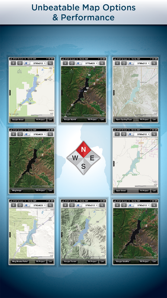
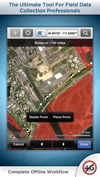
GIS Kit is a field collection and data viewer for iPhone and iPad.
It is designed to help you manage, share, and analyze your field data using the iOS device.
It is an application that works in the background, meaning that it will work even if you don't open the application.
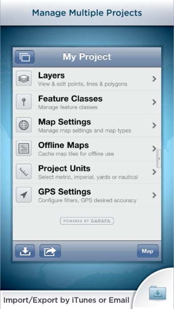
GIS Kit can import shapefiles, kmz/kmx files, and esri shp files.
When you import a shapefile, you will be given an option to convert it to a geotagged shapefile, which will allow you to mark the geotags with the appropriate values.
You will be given an option to import an esri shapefile into the database as well.